PET 2026 · Geography
Isthmus, strait and island channelsस्थलडमरूमध्य, जलडमरूमध्य और समुद्री चैनल
Compare narrow land bridges, water passages and three-sided boundariesसंकरी भूमि पट्टियों, जलमार्गों, द्वीप समूहों और तीन ओर से घिरी सीमाओं की तुलना
Landforms, channels and borders
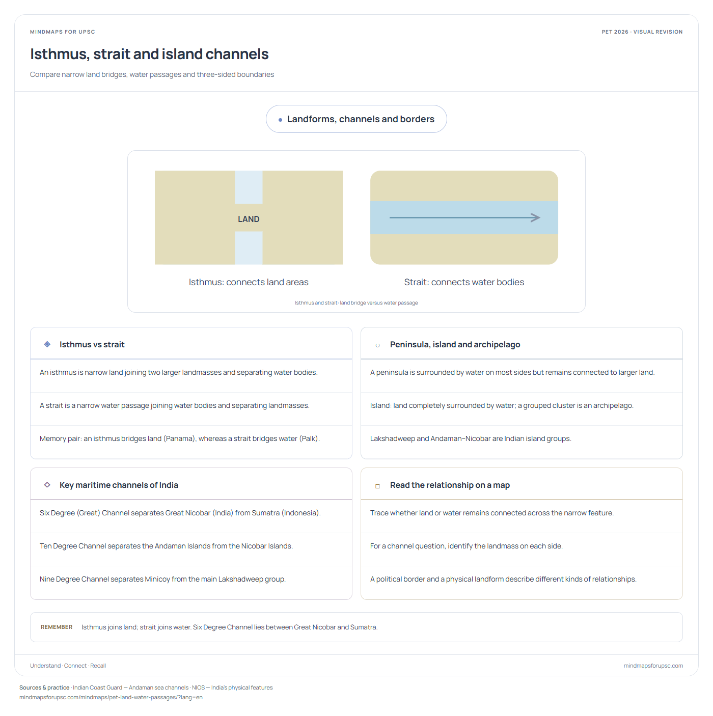
Isthmus and strait: land bridge versus water passageSwipe sideways to explore the diagram.
◈
Isthmus vs strait
- An isthmus is narrow land joining two larger landmasses and separating water bodies.
- A strait is a narrow water passage joining water bodies and separating landmasses.
- Memory pair: an isthmus bridges land (Panama), whereas a strait bridges water (Palk).
○
Peninsula, island and archipelago
- A peninsula is surrounded by water on most sides but remains connected to larger land.
- Island: land completely surrounded by water; a grouped cluster is an archipelago.
- Lakshadweep and Andaman–Nicobar are Indian island groups.
◇
Key maritime channels of India
- Six Degree (Great) Channel separates Great Nicobar (India) from Sumatra (Indonesia).
- Ten Degree Channel separates the Andaman Islands from the Nicobar Islands.
- Nine Degree Channel separates Minicoy from the main Lakshadweep group.
□
Read the relationship on a map
- Trace whether land or water remains connected across the narrow feature.
- For a channel question, identify the landmass on each side.
- A political border and a physical landform describe different kinds of relationships.
तटीय स्थलरूप, चैनल और सीमाएँ
स्थलसंधि और जलडमरूमध्य का अंतरआरेख देखने के लिए दाएँ-बाएँ खिसकाएँ।
◈
स्थलडमरूमध्य बनाम जलडमरूमध्य
- स्थलडमरूमध्य संकरी भूमि है जो दो बड़े भूभागों को जोड़ती और जलराशियों को अलग करती है।
- जलडमरूमध्य संकरा जलमार्ग है जो जलराशियों को जोड़ता और भूभागों को अलग करता है।
- स्मरण सूत्र: स्थलडमरूमध्य जमीन को जोड़ता है (जैसे पनामा), जबकि जलडमरूमध्य जल को जोड़ता है (जैसे पाक)।
○
प्रायद्वीप, द्वीप और द्वीपसमूह
- प्रायद्वीप अधिकांश ओर जल से घिरा होता है, पर बड़े भूभाग से जुड़ा रहता है।
- द्वीप (Island): चारों ओर जल से घिरा भू-भाग; द्वीपों के समूह को 'द्वीपसमूह' (Archipelago) कहते हैं।
- लक्षद्वीप और अंडमान-निकोबार भारतीय द्वीप-समूह हैं।
◇
भारत के प्रमुख समुद्री चैनल
- सिक्स डिग्री (ग्रेट) चैनल भारत के ग्रेट निकोबार द्वीप को इंडोनेशिया के सुमात्रा द्वीप से अलग करता है।
- दस (10) डिग्री चैनल अंडमान द्वीपसमूह को निकोबार द्वीपसमूह से अलग करता है।
- नौ डिग्री चैनल मिनिकॉय को मुख्य लक्षद्वीप समूह से अलग करता है।
□
मानचित्र पर संबंध पहचानें
- संकरी आकृति में देखें कि भूमि जुड़ रही है या जल।
- चैनल के प्रश्न में उसके दोनों ओर के भूभाग पहचानें।
- राजनीतिक सीमा और भौतिक स्थलाकृति अलग प्रकार के संबंध बताते हैं।
Practise this concept · संबंधित प्रश्न
One visual, several questions. These links open the original paper at the matching question.
Sources & study notes · स्रोत
Independent revision material, linked to the paper’s concepts. The question papers and answer-key status are available on OpenPYQ.